Part 87: Q&A - March 24

Empire Total War: The Second 80 Years War quick online Q&A
Q: What was the geo political map of the world, and the war front during this portion of the 80 years war?
A:
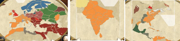
The Dutch and member states under direct Dutch influence are indicated as Orange. Britain is the brighter Red while Poland is the dark pink. Their Ottoman allies are in maroon while their Prussian allies were in dark blue. The neutral Swedish and Russian forces were in blue and green respectively.
In America, the dark green was the nation of Mexico and the brown was the Pueblo nations. In India, the tan colour was the Persian Empire.
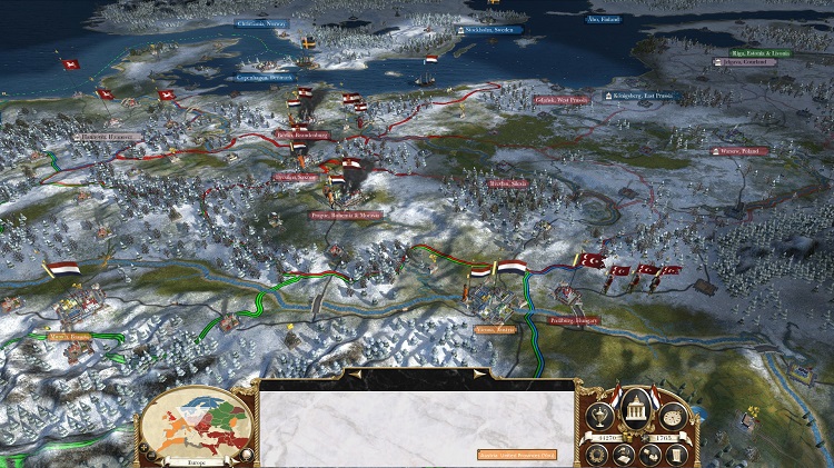
This is the position of the Dutch and Polish forces according to Dutch intelligence. Polish intelligence was burned when the Dutch advanced on Warsaw, so their exact disposition is uncertain. This was the first war in which a contiguous front was presented from the North to the South of Europe without any breaks to allow maneuver, a distinction that has led modern historians to refer to it as the first great war.